Twenty years from now you will be more disappointed by the things you didn't do than by the ones you did.
So throw off the bowlines, sail away from the safe harbor. Catch the trade winds in your sails. Explore. Dream. Discover. --- Mark Twain

Saturday, December 22, 2012

Paraguay


Day 672,
75 147 km since the beginning of the journey,

DSC08814
The border-crossing between Brazil and Paraguay was quite peculiar. Peculiar in this sense that actually there was no real border between the two countries - but just a street in the centre of the town and that was the Border. On one side there is Brazil and a town Ponta Pora and on the other side there is Uruguay and another town named - Pedro Juan Caballero.

Wednesday, December 19, 2012

Bonito, Gruta Lago Azul


Day 669,
74 169 km since the beginning of the journey.

There is an interesting grotto About 20 kilometres from Bonito there is an interesting grotto, in the bottom of which is lake of very clear and transparent blue water. In order to visit the place pre-registration is necessary. The tourism companies in town sell the vouchers, the time of the visit is fixed and only then it makes sense to go to the place. Every half an hour a group of 15 people is allowed to go down to admire the lake and there are four groups moving around at the same time. I had seen the picture of the place before but the sight was more powerful than expected.

DSC08759
Starting descending from the top

Sunday, December 16, 2012

Brasília


Day 667.

Brasilia is the capital of Brazil, the city's name is derived from the name of the country. As early as in 1891 the Brazilian Constitution accepted the clause that in future the capital of the state - Rio de Janero - would to be transferred to a new city.

In 1956 during the election Juscelino Kubitschek promised that when he is the president the country would get the new capital. The town planning competition was won by the architect Lucio Costa and the architect Oscar Niemeyer planned public buildings.
brasilia
The plan - approved by Congress in 1956. The city – built on an empty place – resembles to the image of a bow and arrow, or a bird, or the shape of a plane. The selected location - 125 km away from the railway line, 190 km from the nearest airport and the nearest paved road was 600 miles away, and the wood and the steel had to be brought from a distance of 1200 km (source: RG Brazil).

Friday, December 14, 2012

Pantanal and Transpantaneira

Day 664,
73 798 km. since the beginning of the journey.

Transpantaneira_DSC08461

Pantanal is waiting ahead. Pantanal is considered to be the world's largest wetland area of 140 to 195 thousand km2 and extending to three countries - most of it is in Brazil and a part reaches to Bolivia and Paraguay. Pantanal is a UNESCO World Heritage Site.

Thursday, December 6, 2012

Ubatuba 1


Having visited Santos I drove along the coastal road up towards Rio de Janeiro. There is also a motorway from Sao Paulo towards Rio de Janeiro, but as soon as I have begun to talk to somebody about visiting this area I have always been suggested to ride along the ocean-side road, it is said to be more beautiful and more interesting .The distance from Santos to Rio de Janeiro is a little over 500 kilometers, that is - in theory one could get there in one day, and there will be time left over as well. This is in theory, if we look only at the map.

As there are wonderful views of the ocean and the beaches by the road and many interesting towns - such as Ubatuba and Paraty, then one can`t help spending much more time. I have been advised to consider taking one week and although this seemed to be too long in the beginning and how one could spend a whole week to cover 500 km, then looking back - it is a perfectly proper recommendation. I arrived at Santos on November 9 and at Rio - November 15 in the evening, so all together it took 6 days.

DSC06471_thumb
Some intermediate places to make a stop - Ubatuba was said to be the only city through which the Tropic of Capricorn runs , so again the time has come when the sun will appear directly in the zenith . Again - in theory, because in practice the sun was behind the gray clouds and only warm rain met the head.

Saturday, November 24, 2012

Bolsa Official de Cafe


The Coffee Stock Exchange was situated in an important port town of Santos. The Bolsa Official de Café was opened in 1914 when coffee was an important export product of Brazil, and it was located in this building until 1950.
DSC06199

Tuesday, November 13, 2012

Santos, Aquarium


Day 634
67 307 km since the beginning of the journey.

American_bullfrog
American Bullfrog - can live up to 16 years, grow up to 15-20 cm in length and weigh up to 500 g.

Monday, November 12, 2012

The Roads of Brazil, part 2.


For a change - a couple of weeks old, but more coloured pictures of the surroundings of Urubici.

DSC04247_thumb
Before sunset the sky turned clearer.

The Roads of Brazil. Part 1


I do not want to say that here it rains every day, meanwhile, the weather is quite dry too, but the first photos are gray and while getting out of the car something is dripping in between the collar.

DSC05784
Highway BR-101 between Curitiba and Sao Paulo. At first glance it seems as wide as the Tallinn-Tartu road, but it is a two-way road, the other direction is far behind the mountain and the forest. Rainforest. BR-101 runs near the coast and is nearly 4,800 miles long.

Thursday, November 8, 2012

Technical issues

Day 628,
66 625 km since the beginning of the journey,
Itapetininga, Brazil.

This time about technical issues. Because all the things that are about to fall apart should be repaired immediately, or as soon as possible, otherwise the situation would later be much worse. The first act. As the two rear fastenings of the roof frame were broken for the second time then it was necessary to get an aluminium welding . The broken spot was the same as before. The last repairs were made in the beginning of February, but a lot of weight on the roof and the road conditions in Namibia and Botswana had done their job.
DSC05830
Workshop, first of all - one side is made stronger.

Thursday, November 1, 2012

Curitiba 2


Curitiba_DSC05566
In Curitiba the next very peculiar building is the - Museu Oscar Niemeyer (Museu do Olho or Museum of the Eye). It was opened in 2002. The architect Oscar Niemeyer (born in 1907) had designed the building as early as 1967 already. The two buildings have a total exhibition area of 35,000 square meters .You just take a look around in one hall and in another hall and four hours have passed unnoticed.

Curitiba 1


Day 622,
65 998 km since beginning of the journey,
Curitiba, Brazil,

Curitiba is the largest city in the southern region of Brazil. According to Wikipedia the population of Brazil is 1.76 million and it is the world's fifth largest country, both by area (8.5 million km ²) and population (193 million inhabitants).

Curitiba_DSC05249
The Botanical Garden of Curitiba, Portuguese Jardim Botanico de Curitiba is at the beginning of the list of attractions.

Saturday, October 27, 2012

Tuesday, October 16, 2012

Iguazu Falls, Brazil


Day 606.
64 240 km since the beginning of the journey

DSC03797
Now back to Brazil to admire the Falls near the town of Fox do Iguagu. The weather was once again somehow especially hot and the clouds in the sky and predicted rain.

Wednesday, October 3, 2012

To Brazil


Day 592
63 266 km since the beginning of the journey
Brazil, Foz do Iguacu

The beginning of the story is in the previous post - Brazil without a visa, the first attempt. In short - I can say that the Brazilian Consulate in Puerto Iguazuz found the best solution of their power to my particular case. They were ready to give me the cheapest urgent visa. The price was 100, ARG. All together it took only about an hour. Back at the border, another passport stamp, I gave away the Motor Vehicle Temporary Import and Argentina remained behind again.
DSC03783
 I did stop in the middle of the bridge to make a couple of pictures of this important moment and I was not the only one here to rejoice over the border crossing.

Monday, October 1, 2012

To Brazil without a visa, the first attempt


Day 591,
63 242 km since the beginning of the journey,
Argentina, Puerto Iguazú.

The next border crossing was planned from Argentina to Brazil. It had been reported in media in several places that from October 1, 2012 Brazil would be visa-free for Estonians. Actually it didn´t turn out exactly as expected. It was very simple and comfortable leaving Argentina. To get the exit temple there was even no need to step out of the car and 10 meters further there was another officer to whom I gave over the temporary car admission document. Everything was simple and convenient. In front there is a bridge and on the other side Brazil is waiting.

DSC03771
One half of the bridge has the colours of Argentina and the other half is in Brazilian colours.

Iguazu Falls, Argentina

Day 590,
63 219 km since the beginning of the journey,
Argentina, Puerto Iguazú.

Iguassu waterfalls are at the border of Argentina and Brazil and are an important tourist attraction for both countries. The name "Iguazu" has come from the Guarani language and means "Big Water”. The place is a UNESCO World Heritage Site and worth seeing.

A legend about the creation of Iguassu waterfalls tells us that God had planned to marry a beautiful woman named Naipí, but she instead had fled away with her mortal lover Tarobá in a canoe. The enraged God had cut the river into two, created waterfalls and cursed the loved ones to keep falling down as waterfalls forever.
   DSC03610
A picture tells us more than a thousand words. Only later, when you look at the picture, everything looks somehow much smaller. According to Wikipedia, depending on the level of water there are about 150-300 waterfalls covering the area of 2,7 kilometres.

Sunday, September 30, 2012

Some More About Uruguay


Chuy is a border town of 11 000 inhabitants between Uruguay and Brazil. Something similar to Valga-Valka between Estonia and Latvia, so that the border between them is a wide two-way street called International Street, or to be more exact, the four-way street - so that one two-way is from Uruguay ś side and the other two-way street is from Brazil `s side.

DSC02738
Since I was not intending to get out of this town to Brazil (after all I had no visa ), then I drove on towards Uruguay. While leaving the town there was a police check post by the road. They examined the Estonian registration plate and car temporary admission papers, and after a brief Spanish-English language conversation I could go on.

Wednesday, September 26, 2012

Nandu and the Others


"Reserva de Flora y Fauna del Pan de Azucar". It is a small Zoo by the road.

DSC02360
Nandu. Resembles a bit to an ostrich.

Saturday, September 15, 2012

Montevideo


Montevideo is the capital of Uruguay, the largest city and the largest seaport town with 1.3 million people. The city is located by the River of Rio de la Plata

Montevideo_DSC01812

The first look at the city, on the left there is the highest building of Uruguay, Antel Tower or Torre Antel – 37 floors and 158 m high. The building is open for visitors a few hours a day (Mon, Tue, Wed afternoon, and Tue and Thu in the morning), and the view from the top was said to be beautiful.

Sunday, September 9, 2012

Colonia del Sacramento


Day 569,
61 639 km since the beginning of the journey

The oldest city in Uruguay is Colonia del Sacramento .The number of inhabitants is about twenty thousand and it was founded by the Portuguese in 1680. The town is about 50 kilometres from Buenos Aires and located by the mouth of the Rio de la Plata river . The restored Historic Quarter (Barrio Historico) is a UNESCO World Heritage Site.

DSC01735
Porton de Campo - the city gate (since 1765) and the wooden bridge.

Thursday, August 30, 2012

Uruguay


Day 560,
59 997 km since the beginning of the journey,
Uruguay

Thursday morning began with the absence of the internet connection again. That meant that the connection lasted so long that the message displayed in Spanish reported about the lack of credit. It was a bit of a surprise because I had paid 100 pesos and then used 19 pesos only twice. (for which you get two days or 48 hours), then elementary mathematics shows that there should be still 62 pesos. Should. But still no connection at all.

Since I had planned to drive to Uruguay in the morning the decision was to sort the matter out later. There are about 75 thousand inhabitants in Qualeguaychu. The name of the city comes from the Guarani sentence "The River of Large Jaguar". In January and February a big carnival takes place here.

DSC01514
Juicy mandarins are everywhere on sale.

Pre-Delta NP


Day 558,
59921 km since the beginning of the journey,
Gualeguaychú.

About the weather again. The last days have been drier. I was beginning to think for a moment that what was the point of constantly writing about the endless rain but reaching here, by the river of Gualeguaychú , it turned out that all the rainfalls of the past weeks had caused here a real flooding. At first could not realize the previous situation as the river was flowing nicely and neatly between the banks. Only the shores were somehow too dirty and muddy. And then I was shown the line of the water level on the wall of the house and that was sufficiently high. Almost 3 meters.

DSC01504
The red line in the picture shows the level of the water during the flood.

Saturday, August 25, 2012

Rosario


Day 554,
59 163 km since the beginning of the journey
Argentina, Rosario.

The Memorial of the National Flag of Argentina is situated in Rosario, by the Parana River, as just here, on February 27, 1812 the flag was hoisted for the first time.

DSC01260

Monday, August 20, 2012

Zoo Lujan

.
Day 549
58 798 km since the beginning of the journey.

Lujan is a small town, 60 km from Buenos Aires. There is a very peculiar zoo near the town – most peculiar, because visitors can go inside the cage of the lion and the tiger as well.

DSC01128 
Together with the King of Animals.

Buenos Aires, some more pictures

.
Day 549
Buenos Aires, a waterfront parking lot
58 714 km since the beginning of the journey.

I`ve changed my overnight place. The Tigre Camping Place was quite a nice place, but still 30 km away from the town, it takes more than an hour to reach the town. And not only for the time spent on driving , but simply because it is time to move on. And as the rainy weather does not show any signs of coming to an end somehow, it will be necessary to find a drier area. I met some Germans, who had been travelling in South America for 8 months and they only had had two days of rain. Made me speechless.

DSC00600
Another kind of Buenos Aires. Viewed from motorway which leads to the centre of town.

Wednesday, August 15, 2012

Buenos Aires, Recoleta

.
Day 544
58 503 km since the beginning of the journey,
Buenos Aires,

The size of Buenos Aires is impressive, according to Wikipedia the area is 203 km2 and the number of inhabitants together with the suburban parts of the city is almost 13 million. And the list of the main attractions in the city corresponds to the size as well and “Recoleta” is always on the list.

The place is surrounded by sales counters, everything - which could be of any interest to tourists - is available. Souvenirs, balloons and pies, as usual, belong to one of the city`s most significant sight. Walking in between the stalls I feel that there is something different here and after some time I realize the difference – there is no super-aggressive sale here. But maybe I do not see myself so much like a tourist, because tourists can be usually recognized having a tourist map in the hand and wearing small backpack with a water bottle pocket. And the camera betrays as well. My rucksack and tourist card are left in the car, the car is be left in a guarded parking lot, and the place itself is not far away. A walk a couple of miles is quite useful. And the small Sony camera fits into the pocket freely.

DSC00617

The church - Iglesia de Nuestra Senora del Pilar (ie the Virgin of Pilar) - built in 1732 is seen from the distance.

Sunday, August 12, 2012

Buenos Aires, Tigre

.
Day 541,
58,426 kilometres since the beginning of the journey,
Buenos Aires, Tigre

DSC00556

It is raining. For some time - just rain and then again real downpour. And everything around is gray. Meanwhile even some mosquitoes are flying around, but they don`t matter as here, in Buenos Aires, there is no malaria and no necessity to take Malarone for prophylaxis. They say that Malarone has no side effects, and when you start to take them you do not feel anything, but once you quit taking them – you really feel yourself much better. Still chemistry.

Thursday, August 9, 2012

Season 2 - South America

Argentina,
Buenos Aires, Tigre
58,360 km since the beginning of the journey

I'm not going to make a long introduction here - as there was no progress in writing in the meantime, nothing to do. Not because of anything has not happened, but rather on the contrary, all sorts of things are happening and too many changes too often. And in case there are too many activities in progress, then, at first you try to accomplish the necessities at first again and get the situation under control.

So I will continue to reflect the current situation, as by now I have reached the next continent, namely - South America, Buenos Aires, the capital of Argentine.

Buenos_Aires_1

Sunday, June 10, 2012

Botswana, Maun

So – time to write again.

The first issue of attraction is about 90 kilometers from the border of Namibia –Botswana - Tsodilo Hills - which is Botswana's first and the only UNESCO World Heritage Site. Worth to visit. I turn to the side road and give a lift to four locals who are standing by the road and waving their hands and it comes out that they wish to go to the same village. Later I learned that there is no public transport to the village. So there is 40 kilometers of extremely dusty and slightly uneven village road, then there is the village and next to it - the mountains.

Should be the right place. No signpost or any label in sight, but the locals show me the right direction. A sandy trail takes to the main entrance. There is not anybody there. But the gate was unlocked and fresh tracks of car wheels on the road – what else to do than open the gate and drive on.

About 5 kilometers away there is a small museum, an overnight site and some guides waiting for the visitors.

DSC03470

Monday, May 28, 2012

Botswana

.
Day 493
55,155 km since the beginning of the journey
Maun.

After a longer period - a border-crossing again. This time - from Namibia to Botswana. This border- crossing is the twenty-ninth one of this trip. It is not just a special birthday or something. But still unique - as Botswana is one of the three mainland African states where Estonians can enter visa - free, the other two countries being Morocco and Swaziland.

DSC03424

Wednesday, May 23, 2012

The San People

.
Day 488
54,588 km since the beginning of the journey
Written in Namibia, Divundu.

It is very probable that the San People are the first settlers of the present region of Namibia, and have lived here long before the arrival of other tribes. The San People have been also called "Bushmen", but they themselves prefer the name “The San People ” - given them by other tribes. They mostly live in Botswana (55,000), Namibia (27,000), South Africa (10,000) and Angola (<5000). Wiki. The San still live “close to nature”, although modern civilization is reaching their villages as well.

DSC03048

The San village. First of all, there is 75 kilometers of properly dusty road with some traffic, which means that within an hour perhaps five cars were coming. Nobody passed me and I didn`t pass anybody either. Then in the middle of the road there is a barrier and the crossing of the next veterinary border. Another hundred meters and by the road there is a big sign - "Living Museum of the Ju / 'Hoansi-San", which means that the place is near.

Sunday, May 20, 2012

Tsumeb

.
Day 485
53,809 km since the beginning of the journey

Written in Namibia, Divundu.

Tsumeb is the next small town (the number of inhabitants - 15,000) in Northern Namibia, there are a few gas stations, Spar and some larger stores, so a suitable place to renew the fuel and food supplies. And try to sort out the pictures of zebras from Etosha Park , which seems at first sight quite hopeless endeavor. And not just at first glance.

In the main street of Tsumeb I have a little walk and buy myself a pair of new flip-flops. The previous pair lasted less than a month, and this is somehow too short time. And before that the ones bought in Djibouti lasted almost a year. In a small shop with a wide assortment of high quality all the major brands is represented. In a large basket there are friendly mixed up NIKE, PUMA, etc. products.  Frankly, I would have liked to have that kind of footwear as seen in the photo below.


Nothing to do. Could not get those. My purchase is placed in a plastic bag and - visit us again. I'm moving on.

Tuesday, May 8, 2012

Etosha

.
Day 473
53,225 km since the beginning of the journey

Etosha National Park was founded in 1907, the initial size of the park was 100.000 km2, and at this time it was the world's largest national park. Currently, the park covers an area of 22,270 km2.

And the price of the tickets is customer-friendly. The day ticket of Etosha will cost 90 N$, that is 9 EUR and it means - 80N$ per person and 10N$ per car.

DSC02817

Sunday, April 29, 2012

And more about Namibia

.
Day 463
52,109 km since the beginning of the journey.
Opowo.

Some pictures from the last week route. This is a very common sales outlet by a smaller road.
DSC01538
The sales desk is a bit further in the left , the souvenirs for tourists are hanging on the cords. The tent in the right is for lodging.

Thursday, April 26, 2012

"The Big Africa Cycle"

... and Peter Gostelow. I am driving along a dusty Namibian road towards Opuwo and notice a cyclist approaching me from the distance. He is far away but nevertheless it is clear that he cannot be a local rider. We stop and take time to have a proper talk.

DSC02286

Two and a half years of cycling through Africa, including the Central African Republic, and 4 months in the DRC. The destination - Cape Town.

His website is here - The Big Africa Cycle, I've read about his impressions about Congo before ,but I did not believe that we will meet in Namibia.!

This is just another answer to the question "What kind of a car to Africa?". And today's answer is that - "It is also possible without a car!"

Respect!

Monday, April 23, 2012

Damaraland

.
Day 458
Kamanjab,

51,377 km since the beginning of the journey

Damaras are one of the Namibian tribes, there are about 100,000 of them in this tribe and they are among the oldest inhabitants of Namibia. "Living Museum of the Damara" is a small Damara village near Twyfelfontein, in north-west of Namibia. It is an open-air museum, with a dozen semi-transparent round huts, and visitors can have the opportunity to follow the daily activities of the Damaras.

DSC01757

At the moment of the arrival there are no tourists in the village, the chief of the village is appearing from a distance.

Thursday, April 19, 2012

Spitzkoppe

.
Day 454
51,132 km since the beginning of the journey
Namibia.

Swakopmund, Walvis Bay and civilization has been left behind. The Colony of Seals has been visited, and so have Welwitschia and the Moon Landscape. The shopping centres have been walked through and the choice of the articles is plentiful. And at the cafeterias the situation is the following: when you order a pizza, then you are brought the real good pizza - both in appearance and taste.

DSC01491
The Trans - Kalahari Highway takes through the desert to inland.

Sunday, April 15, 2012

Welwitschia Mirabilis

.
Welwitschia is an unusual ancient plant that grows in the desert of South Namibia and in Southern Angola. And it looks like a strange pile of dead leaves withered from the ends.

The plant consists of a low stem and only of two leaves, the ends of the leaves are broken and dead . It is a “gymnosperm” and is adapted to live in the desert and having only the root and leaves. The plant can live up to 1,500 years, the leaves grow throughout the life of the plant, but they decay from the ends and their length does not exceed 4-5 meters.

It is said that in 1860, when the Austrian botanist Friedrich Welwitsch - while travelling in South Africa- discovered that plant - he fell to his knees and didn´t dare to touch it for a long time.

Welwitschia blooms only once in its lifetime.
Welwitschia_DSCN6449
Welwitschia is adapted to extreme desert conditions, it does not depend on rain water, but can acquire water from fog clouds coming from the ocean.


Swakopmund

.
Day 450
50,583 km since the beginning of the journey

Last week route: Windhoek, Walvis Bay - Swakopmund.
Written in Swakopmund, which is small and like a genuine German town by the Atlantic Ocean in Namibia.
Swakopmund_DSCN6587
Hohenzollen House – a hotel - built in 1906

Thursday, April 5, 2012

Windhoek

.
Day 440 

Katutura – in the local Otjiherero language it means - "The place where we do not want to live".

Some lines about the history of the city: Windhoek is situated at an altitude of 1650 meters and according to one legend has got its name due to hot-water springs, Nama people called this place Ai-Gams (fire-water) and Hereod named the place - Otjomuise (meaning "place of steam").

The Germans arrived here in 1890 and built a fortress by the name of Alta Feste, which became the headquarters of the German colonial troops or Schutztruppe.  Currently there is a museum at the castle. The German colonial era came to an end during World War I when South African troops occupied Windhoek in May 1915. In 1950s the town Government together with the SA apharteid regime wanted to build separate areas for locals (such as Soweto near Johannesburg). The local residents did not want to move to Katutura and the encounter on December 10, 1959 ended with bloodshed and with the death of 13 people.

The resettlement then continued without any incidents and was over in 1968, when almost all of the black population was living in the new area.  In 1968 in Katura the number of the houses was about 4,000, they were all rental houses - could not be bought or sold, there was neither  water and nor electricity.  Each house had to have the tribal identification number (H = Herero, D=Damara, etc.). After Namibia's independence in 1990 the restrictions of the residence were abolished, long-term residents were given the right to buy their own housing forever. In 2006 there were more than 150,000 inhabitants in Katutura and the population  continues to grow as people are arriving  from rural areas in search of work and better life.

Windhoek (149)

Wednesday, April 4, 2012

Some more pictures about Lüderitz

.
Felsenkirche or "Church of the Rock" is the highest building in Lüderitz. The construction of the church was funded by donations, the cornerstone of the church was placed in November 1911, and the Church was opened on the 4th of August 1912 . The architect and builder of the church was Albert Blauset from Cape Colony. The church is a National Monument of Namibia since 1978

Luderitz_Church (19)

Kolmanskop Ghost Town

.
10 kilometers before the town Lüderitz there is an abandoned mining town Kolmannskuppe or Kolmanskop by the roadside. The town was founded in 1908 while during the railway construction the first diamond was found there. In Kolmanskop was a school, theatre, sports hall, bowling alley, casino and hospital, there was also the first x-ray machine in the southern hemisphere. Due to the discovery of new and richer diamond regions the town was abandoned and the last resident left in 1956.

Kolmanskop_053
The town is open to visitors from 9 to 13, and the price of the visit is 55 Namibian dollars
(N $). And in the price-list there is also all day ticket, which is called Photo Permit and costs 160. N $. And this "Photo Permit" means that one is allowed to stay in the town from sunrise to sunset and take pictures.

Tuesday, April 3, 2012

Lüderitz, Goerke House

Namibia.

The description of this house begins usually with the words "The One of the most beautiful buildings in town."

The house is named after the first owner, Hans Goerke, who arrived in Namibia (which at that time bore the name of German South West Africa) in 1904. He belonged to the staff of the German colonial troops (Shutztruppe. After finding diamonds in Kolmanskoppe Goerke left the army and started to work as the manager of the diamond mine.

Goerke_House (45)

The house was built in one year, the construction began in October 1909 and the house was completed by September 1910. Very likely the architect was Otto Ertl. Hans Goerke himself lived in this house for two years, and then left for Germany. The guide of the tour said that Goerke`s wife had not wished to live in that house.

Sunday, March 25, 2012

More about Namibia

.
Day 429
49,659 km since the beginning of the journey
Current Location: Namibia, Windhoek

I am leaving Sesriem as the red sandy hills of Namibia have been looked over during two unique moments : at sunrise and at sunset. And at two o`clock it is too early to consider to stay here for one more day. Before leaving I visit a gas station. Namibia is sparsely populated and that's why I use every opportunity to refuel. Could also be less frequent, there has been now some sort of refueling opportunity every 100-200 kilometers.  Basically, the bus usually can run on the fuel with up to 1,500 km without refueling, but still more secure to have enough proper fuel. About diesel quality - interestingly, the fuel here seems to be of better quality than in some other countries.

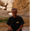
There is a cafe at the gas–station. The tables are outdoors and there is a motorcycle with Australian license plate. Too rare meeting to move on without changing information. We talked at least for a couple of hours.

I drive on northwards, look at the map and notice a familiar name, Solitaire.

Namibia_DSC00892
I make a stop, here's a gas station, auto repair shops, small coffee shops. And here too the vehicles of the last century are used to design the place.

Saturday, March 24, 2012

Namibia, Sossusvlei

.
The big red sand dunes of Sossusvlei and Namibia. In case there are somewhere only two postcards on sale, it is very likely that one of them is of Sossusvlei dunes.

Sossusvlei_DSC00668
It is advised to visit the dunes at sunrise or sunset, as shadows bring out the sharp contours of the dunes, at midday the effect is smaller.

Sunday, March 18, 2012

Lüderitz, Dias Point

.
While in search of the sea route to India the seafarer Bartolomeu Dias stopped at the place where Lüderitz is situated nowadays. About the previous names of Lüdenitz- in 1487 going southwards Dias gave the name of Angra das Voltas to the place. The next year on the way back to Europe he renamed the place. The new name was Golfo de Sao Cristovao (the name of his flag ship had been São Cristóvão).

The next visitor, Vasco da Gama , renamed the bay .The new name was Angra Pequena (in English "small cove"), or a small bay.

Seeking for the sea route to India Dias left there the smallest of his three vessels with 9 seamen keeping guard on it, but later when he returned there were only three of them left. Link. The locals had killed six of his men, the seventh was seriously wounded and died at the time when his companions arrived. The small vessel was in such a poor condition as well, that Dias decided to burn the ship, and returned back to Europe with two vessels.

Dias Point is situated 18 miles west of Lüderitz, at the top of the cape. The first stone cross was built here by Padrão Dias in July 25, 1488, and in spite of the wind and weather conditions - lasted until the 19th century. In 1825 the cross was found broken and smaller pieces of it were taken to the Cape Town Museum.

DSCN5167

Friday, March 16, 2012

Namiibia, Diamond Area 1

.
Day 420
Lüderitz.

The area southwards from Lüderitz is called - The Sperrgebiet in German , "prohibited area" or by the direct the name - "Diamond Area 1." The length of the area from north to south is 320 km and the width - up to 100 miles. And all together this area is 26,000 km2, that is larger than half of Estonia. Diamond mining started around here in 1908, when during the railway construction work the first diamond was found.

Mining it's not the most appropriate word, as diamonds were picked just from the ground in the beginning. Mining is still in progress, each year the machines raise about 33 million tons of sand.

Some facts about diamonds of Namibia. About 3,200 people are employed in the area, and in 2010 about 1.2 million carats were mined, which is 1.5% of the world production. It makes an annual production of 240 kg per year (1 carat is 0.2 grams). Diamonds are even on the Coat of Arms of Namibia.

DSCN5292
I became interested in the area to see by myself but that was not allowed. No chance.

Monday, March 12, 2012

Legends Vanish or Wadi Halfa Ferry

.
Cape to Cairo. The original idea was to unite all the English colonies in East Africa and one of the supporters of the idea was Cecil Rhodes. Although Rhodes preferred railway. Railway, however, is still not built.

Cape to Cairo is a kind of a legendary journey through East Africa. And some places, and some procedures that must inevitably be passed are a part of all that. You could say that they are such "stamp in memory" situations and are an integral part of this legendary journey.

One of the first issues is the check-in of a car (or motorcycle) in Egypt. The procedure, which I tried to remember and to write it down, but after having visited the tenth official (I think) got confused it got mixed up.

The next important place in this journey is Aswan. You can go down from Cairo to Aswan along different routes - through the Black and White Desert and the oases, along roads that are built on the Nile valley, a certain distance along the coastal road by the Red Sea.

But if one wishes to travel from Egypt to Sudan, then one can go there only by boat. By a real ship, not by the desert ship as camels are sometimes called. And the ship goes along the Nile River, or more precisely along the Lake Nasser.

DSCN2151

Thursday, March 8, 2012

Namibia, Fish River Canyon

.
Day 412

48,716 km since the beginning of the journey.
Current Location: Lüderitz

The Fish River Canyon, located in the southern part of Namibia, is advertised as the largest in Africa and the second largest canyon in the world after the Grand Canyon in Arizona. The Fish River Canyon is 161 km long, up to 27 km wide and in some places more than 550 m deep. While in Namibia - surely - a place like this should be visited.

DSC09464
The first sight is really overwhelming. Only - no visitors. And not only visitors are missing, but no locals as well. Nobody offers to guard the car, nor sells anything.